Bellingcat Challenges: Urban Exploration
Continuing this series of write-up explaining how to solve the OSINT challenges offered by Bellingcat for the end of 2024. The tools used are listed at the end of each section. I am not affiliated with Bellingcat. The previous write-ups can be found here:
As per Bellingcat’s wishes, the complete images are not included to avoid polluting the image reverse search results, however a description in italic has been added as well as a link to the picture. The challenges are available here.
The answer to each challenge is highlighted in bold at the end of its section.
1 — Name that street!
There are plenty of areas to walk in cities around the world, and this street is one of them.
But where is it?
What is the name of this street?
Puzzle by Kolina, Bellingcat
The accompanying picture shows a street, seemingly in a city center. Buildings, approximately four stories tall, are located across the street. Cars with visible license plates are parked near it. See the full picture here.

This first exercise is quite simple, zooming in the picture we see a street sign with German words on it, a German license plate and a store named: JP STOFFE.
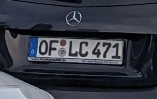
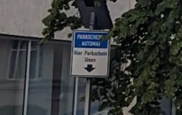
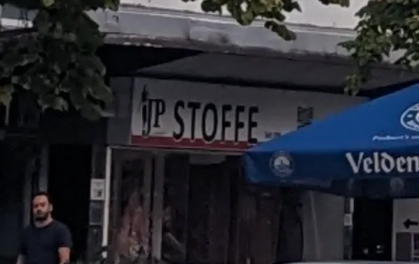
We know that we are likely in Germany thanks to the first two clues, hopefully the last one will help us to narrow it down further. Searching for JP STOFFE in Google Maps yields only three results, all near the German city of Frankfurt:
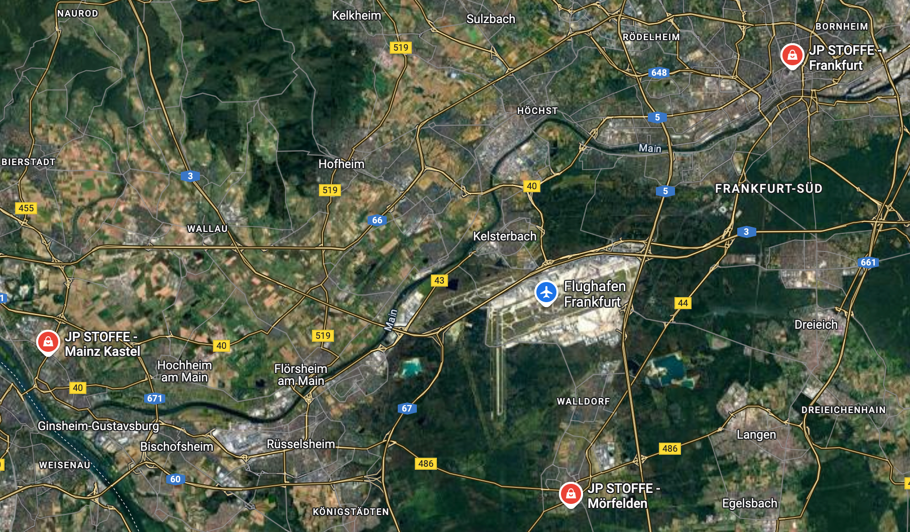
After testing the three possible locations, the North-East one seems to be the correct one. This can be confirmed using Google Street View. The name of the street is Stiftstraße.
Tools and Websites
Google, Google Maps, Google Street View.
2 — What a Dump!
Sometimes the most interesting things are found in the most unexpected places…
… but sometimes those places are full of trash.
This dumpster is in an alley somewhere, but where?
Where was the photographer standing when they took this photo? Use latitude and longitude in decimal format with three decimals (12.345, -67.890).
Puzzle by Jake, Bellingcat
The accompanying picture shows a green dumpster with several graffiti and a partial phone number. The surrounding alley is full of graffiti. There is a small, bridge-like, structure connecting two building on each side of the alley. See the full picture here.

Let’s direct our attention to the dumpster mentioned in the description of the challenge. There is a white logo on it, as well as two graffiti.
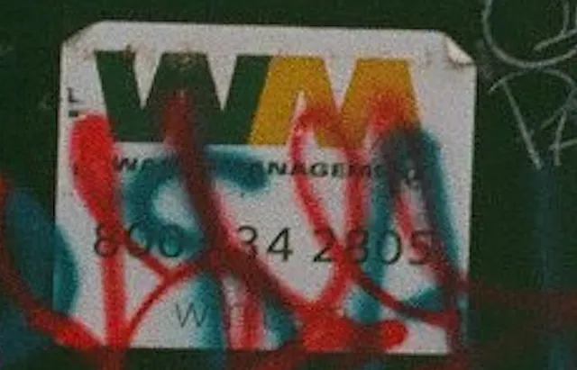
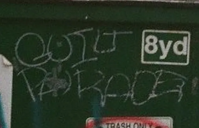
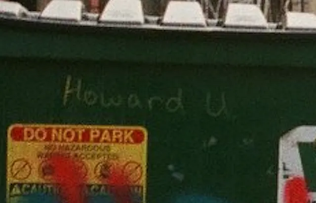
The logo belong to the company Waste Management, Inc. which, according to its Wikipedia page, operates in North America.
Guilt Parade is a music band from Washington DC, according to their Bandcamp profile.
Howard U seems to be a reference to Howard University, a research university also located in Washington DC.
Using Google Lens on the roofs on the left side of the alley and adding “Washington DC” in the search bar yields several results mentioning Brentwood, a neighborhood in DC. If we repeat the same process on the entire picture the Instagram post below comes up. Accompanied by a caption mentioning Minetta Tavern, this image bears similarities to our picture: brick buildings full of graffiti, worn out concrete slabs as pavement, dumpsters, and taller building surrounding the alley. While none of these elements are unique individually, their combination is close to the exercise’s picture.
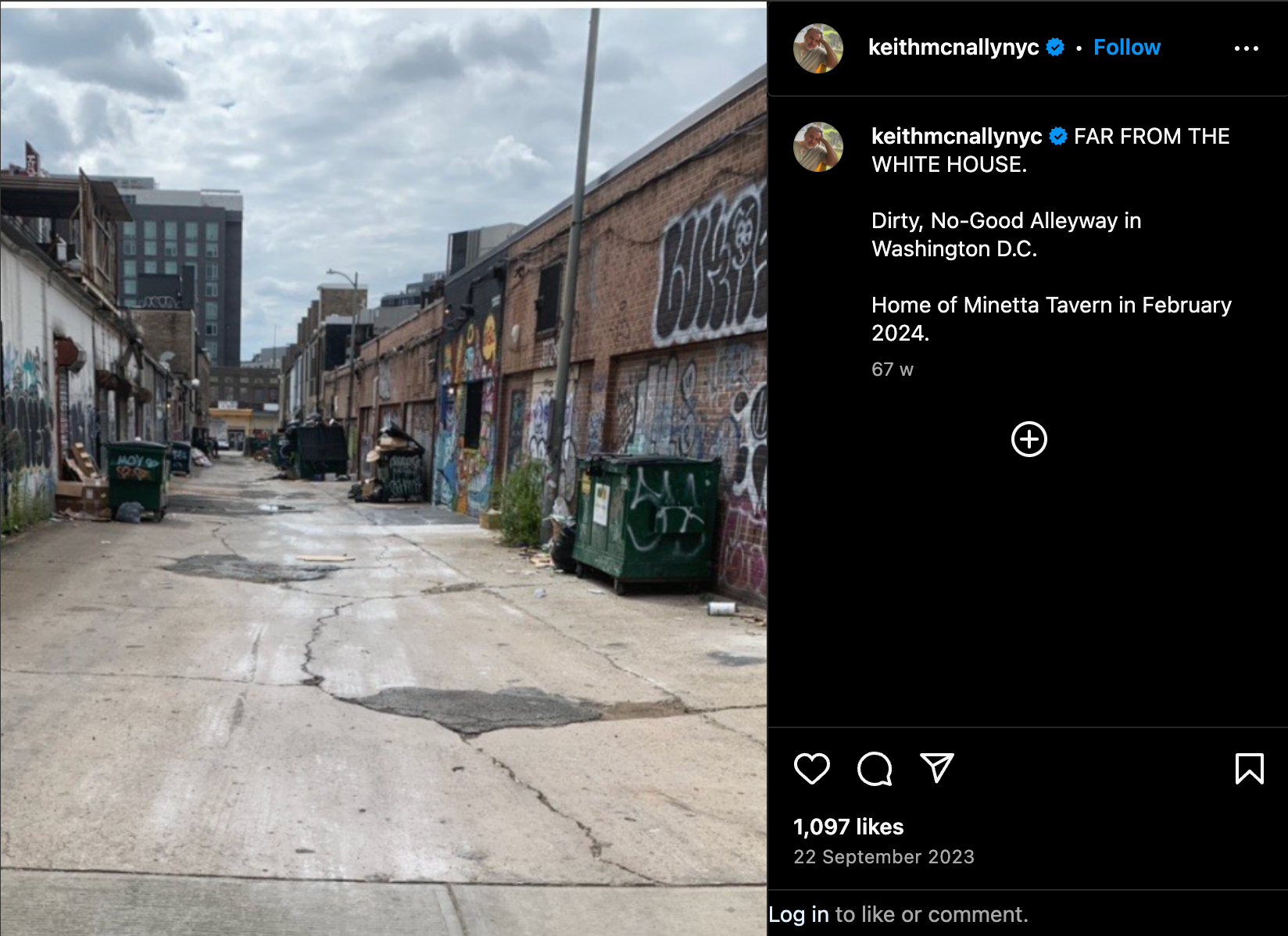
Minetta Tavern is located less than two mile from Howard University and near Brentwood. Looking at the streets nearby with Google Street View, we stumble upon this familiar view:
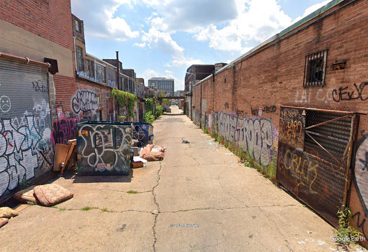
After searching for the Street View picture closest to the exercise picture, we end up with the following coordinates: 38.909, -76.998.
Tools and Websites
Google Lens, Google Street View, Google, Google Earth Pro.
3 — Highway to the Unknown
A car’s moving quickly along a highway, luckily there are some visible structures in the rear-view mirror and on the road-side to help you with your geolocation.
The prominent building bears the name of a person, what is that name?
Puzzle by Lucy, Bellingcat
The accompanying picture shows a red car, speeding down a highway with a black contraption on its roof. A side view mirror can be seen on the foreground, showing a pedestrian bridge. In the background, a two story building surrounded by trees can be seen. See the full picture here.

The amount of information in this picture can be overwhelming: the species of tree, the markings on the side of the road, the make and model of the car, its license plate, the pedestrian bridge, the water tank on the roof of the building, the English words on the side view mirror, the right handed driving and the large black object on the car’s roof.
All of these could be the start of a reasoning to understand where this picture was taken. But not all of them will lead us to the answer, and not in the same amount of time. Let’s focus on the clues that allow us to eliminate the widest area.
Driving on the right and speaking English
Because of the vegetation and architecture, we will assume that this was taken in Africa. To narrow down the list of possible countries, we can use the right handed driving and the use of the English language in the side mirror. Let us keep only the African countries that use English as an official language and drive on the right using these two Wikipedia article:
- Left- and right-hand traffic
- List of countries and territories where English is an official language
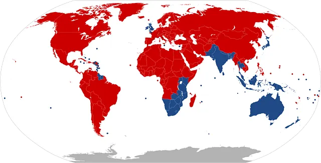
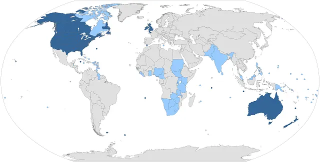
This leaves us with the eleven following countries: Burundi, Cameroon, Eswatini, The Gambia, Ghana, Liberia, Nigeria, Rwanda, Sierra Leone, South Sudan and Sudan.
Is this plate regulation size?
To remove countries from this list, we can use the license plate. Although it is too blurry to make out the exact country, we can use its white background and its dimensions to exclude countries.
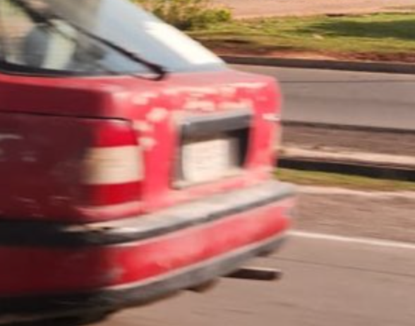
Using the website WorldLicensePlates.com we can examine the format and colors used by the countries on our list. For example Cameroon and the Gambia can both be taken out, respectively because of the background color and the dimensions of the plate, too narrow to match the picture.
Press enter or click to view image in full size
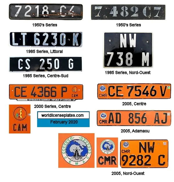
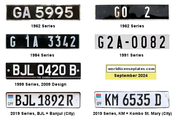
Using this process, we can focus our efforts on three countries that best fit the license plate: Nigeria, Sudan and South Sudan.
We will cross that bridge when we get to it
We can use Overpass Turbo to look for features present in our picture. The first obvious feature is the road but we need a second one: the bridge in the side view mirror, likely designed for pedestrians judging by the size of its railings.
We need to design a query that will highlight the kind of road shown in the picture and a pedestrian bridge. To know what kind of road this would be tagged as, we can refer ourselves to this discussion on the topic. From this page, the suitable values for highway seem to be motorway, trunk and primary. Because we want to run this query over large areas, let’s not forget to add a higher timeout value.
This allows us to write the following query.
[out:json][timeout:250];

// get roads matching the picture
(nwr["highway"="motorway"]();
 nwr["highway"="trunk"]();
 nwr["highway"="primary"]();)->.main_highways;


// get bridges that are also a footway
(nwr["bridge"]["highway"="footway"]();)
->.bridges;

// get bridges that are next to our set of roads
nwr.bridges(around.main_highways:1);

out geom;
After running it on our three remaining countries, it appears that only Nigeria offers suitable locations. See a screenshot of the results below.
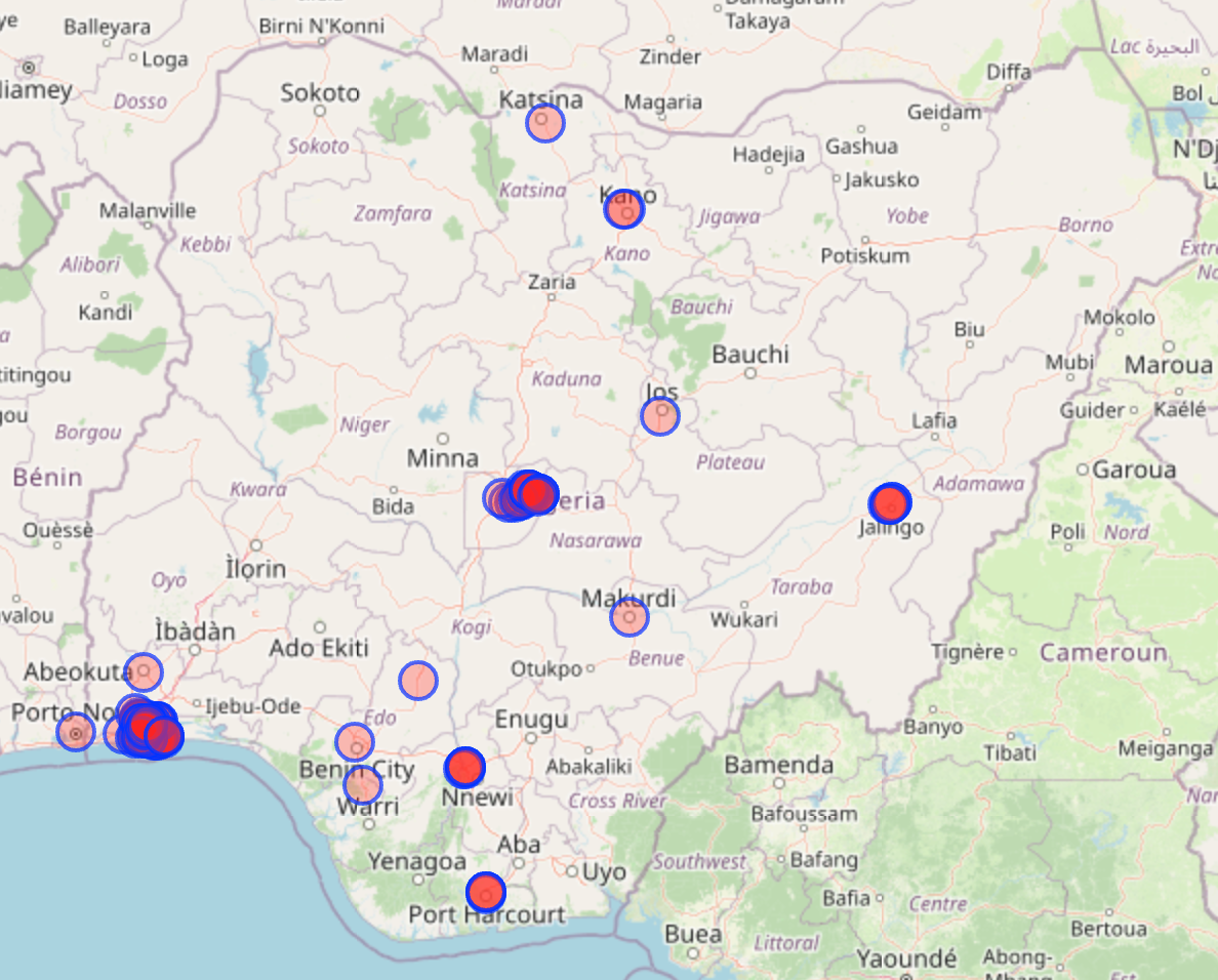
As the number of results is quite large and verifying them with Google Street View is more comfortable, a good way to review these results is to export them as KML files to visualize them in Google Earth Pro. The two main areas concentrating these results are Lagos and Abuja.
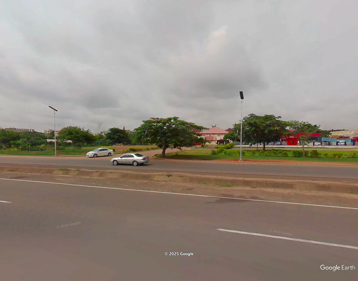
After reviewing several of these results, the exact model of LED streetlight shown in the picture (white pole with a flat top) seems to be mostly found in Abuja. This is where we will focus our research. This gives us a lot less results to verify.
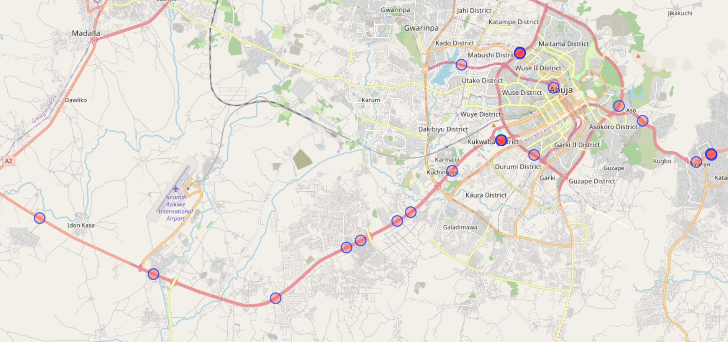
After verifying the results of the OverpassTurbo query, we find the location where the picture was taken: 9.077139, 7.431690.
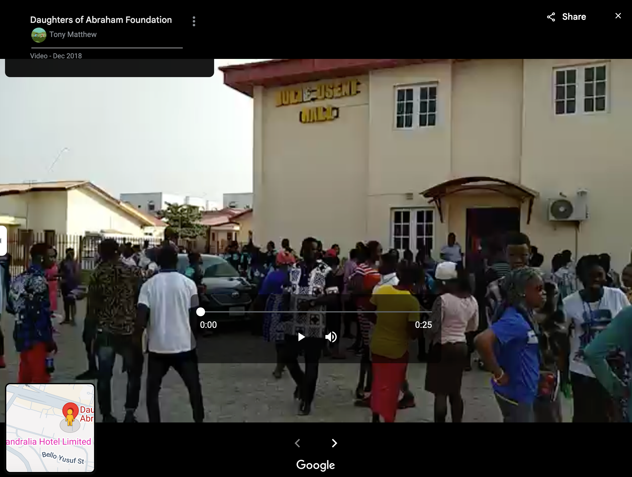
On Google Maps, this building is identified as the Daughters of Abraham Foundation. The video tab from this page has several entries, including this one showing a building featuring yellow letters spelling: Julie Useni.
Tools
Google Street View, Overpass Turbo, Google Maps, Google Earth Pro, OpenStreetMap Wiki, WorldLicensePlates.com.
4 — Foul Play
This is what it looks like to be on the receiving end of a foul ball at a baseball game.
Be careful out there! But who is responsible for this hit?
What is the name of the batter?
Puzzle by Giancarlo, Bellingcat
The accompanying video is eight seconds long. It is shot from the seats of a baseball arena. People seated in the foreground are wearing light blue jerseys. A match is being played on the field. Link to the video here.
Taking a good look
Several avenues could be explored here: finding the venue as well as the teams playing, then finding the match and checking which player hit a foul ball.
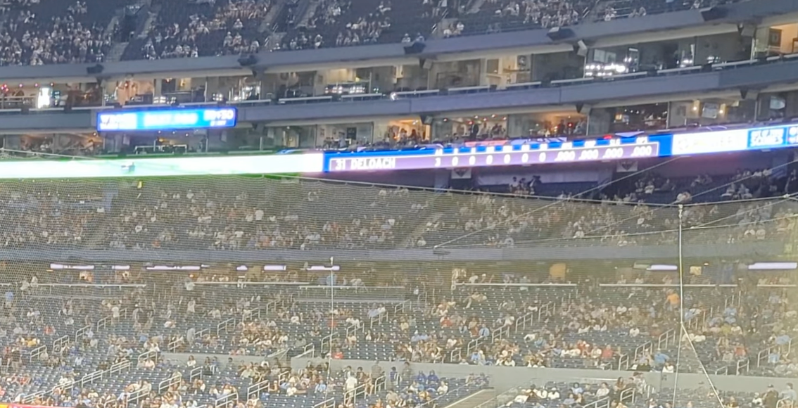
However, before proceeding with our investigation, it’s essential to ensure that we haven’t overlooked any important details. Here for example, the ribbon video board is displaying a name and a number: 31 DELOACH.
Justifying our answer
One could input that answer and go to the next challenge, but being able to argument a finding is as important as the finding itself. So let us verify that answer by finding the match. According to his MLB page, Zach DeLoach plays for the Chicago White Socks.
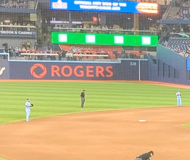
To find the opposing team, we can look at the jerseys some of the fans in the stadium are wearing, specifically the one with “Bichette” on its back. According to his MLB page, Bo Bichette plays for the Toronto Blue Jays. Moreover, there is a blue advertisement stating “official hot dog of the Toronto Blue Jays”. This leads us to believe the video has been taken at the Rogers Center, home of the Blue Jays.

We can use the information we just learned to find the match. The Google search white sox vs blue jay roger center play by play yields two recently played matches: the 21st and 23rd of May 2024; but only one of them mentions a play similar to the one in our video. In the match of the 23rd of May, ESPN Singapore reports that “Deloach flied out to left”. This confirms our answer, Zach DeLoach is the batter in this video.
Tools and Websites
5 — On The Metro
Watching the metro go past.
Where is the photographer, what is the line, and where is the train heading?
What is the destination station for this train?
Puzzle by Michael, Bellingcat
The accompanying picture shows a metro platform, from which a red and white train is departing (or arriving?). Someone is standing at the end of the platform, seemingly looking at the wall. See the full picture here.

Finding the metro lines
As suggested by the title and confirmed by the architecture of the station and the fact that it seems to be underground, this is a metro station. Our next step is determine the city in which this station is located. We can use the train livery to do so. Google Lens gives us several results, but this particular one matches both red lines and what seems to be horizontal folds in the metal underneath:
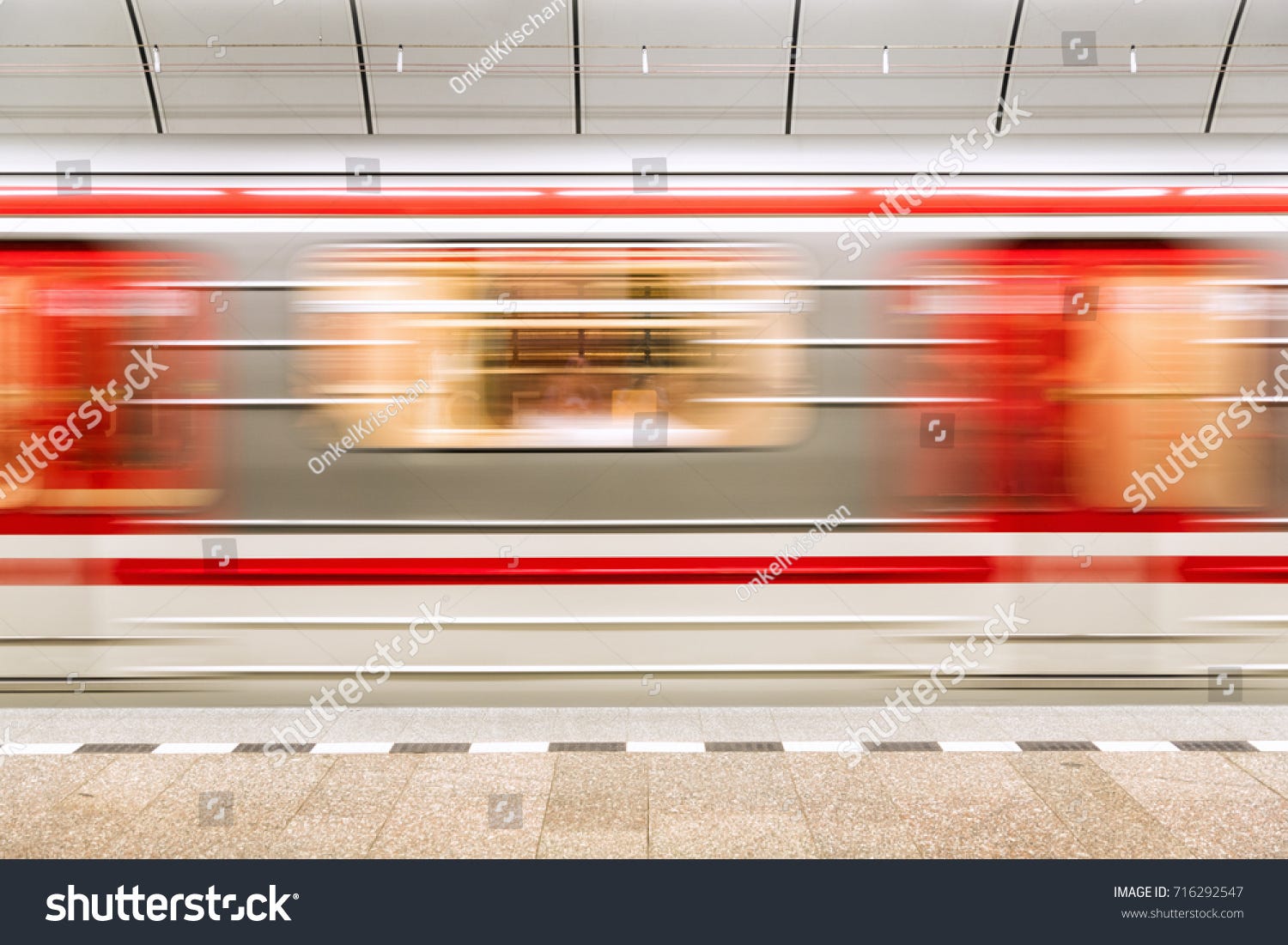
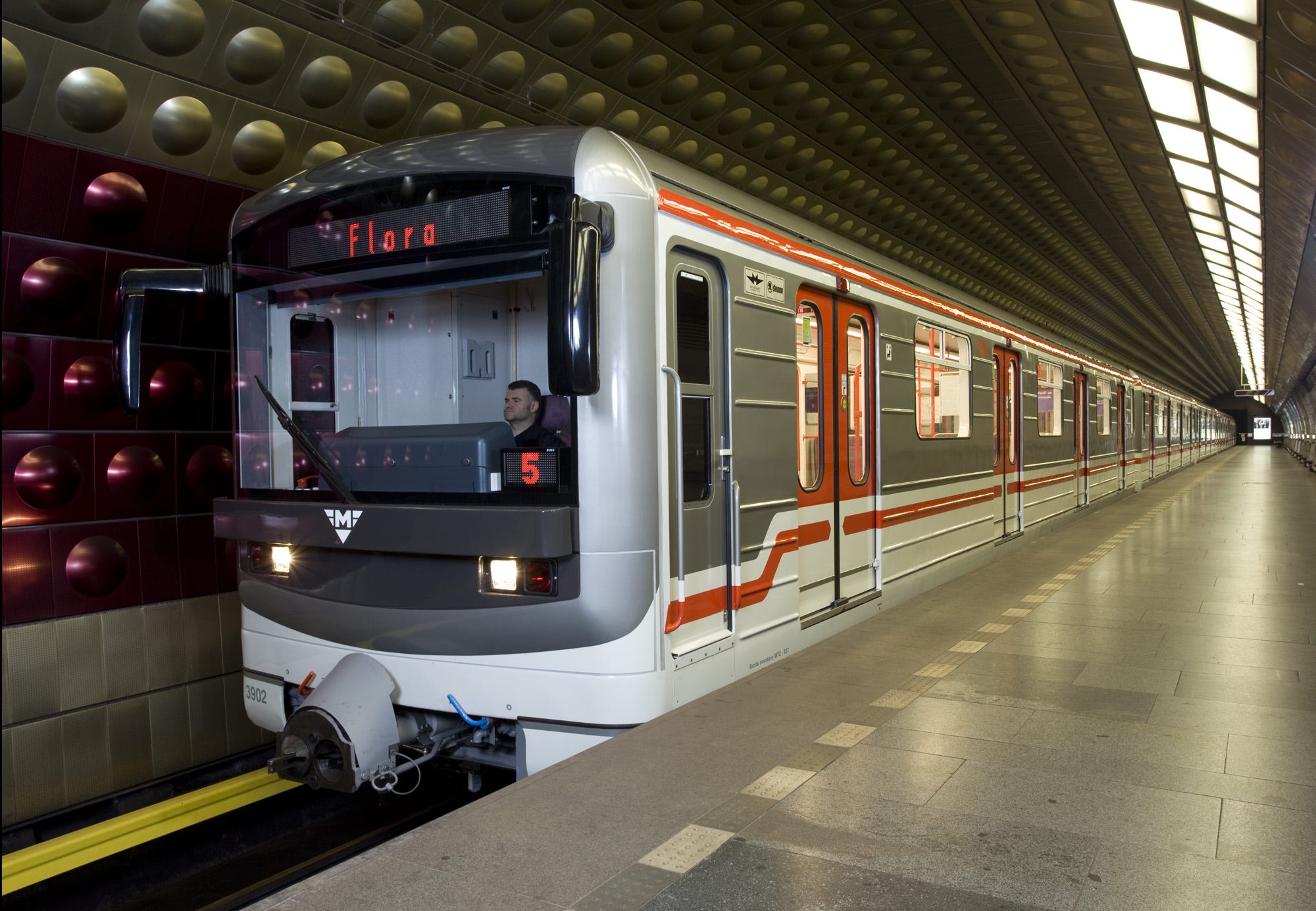
Similar photographies recommended by Shutterstock, identify this location as the Prague subway. According to its Wikipedia page, this particular subway system only has three lines, which will simplify our search. To narrow it down further, the same page details the rolling stock used: Metro M1 trains and 81–71M trains. The latter matches our picture and is used on lines A and B of the Prague subway.
Finding The Station
Fortunately, UrbanRail.net contains pictures of the metro stations on the lines we are interested in. To accelerate this process, let’s focus on the three following points: the square shape of the train tunnel, the black tiles on the wall and the rectangular light fixtures. After finding suitable stations, we can look at the vlogs from this YouTube channel to confirm which side of the platform is shown. Hůrka seems like the most likely place where this picture was taken. See below a comparison of the picture and this YouTube vlog.
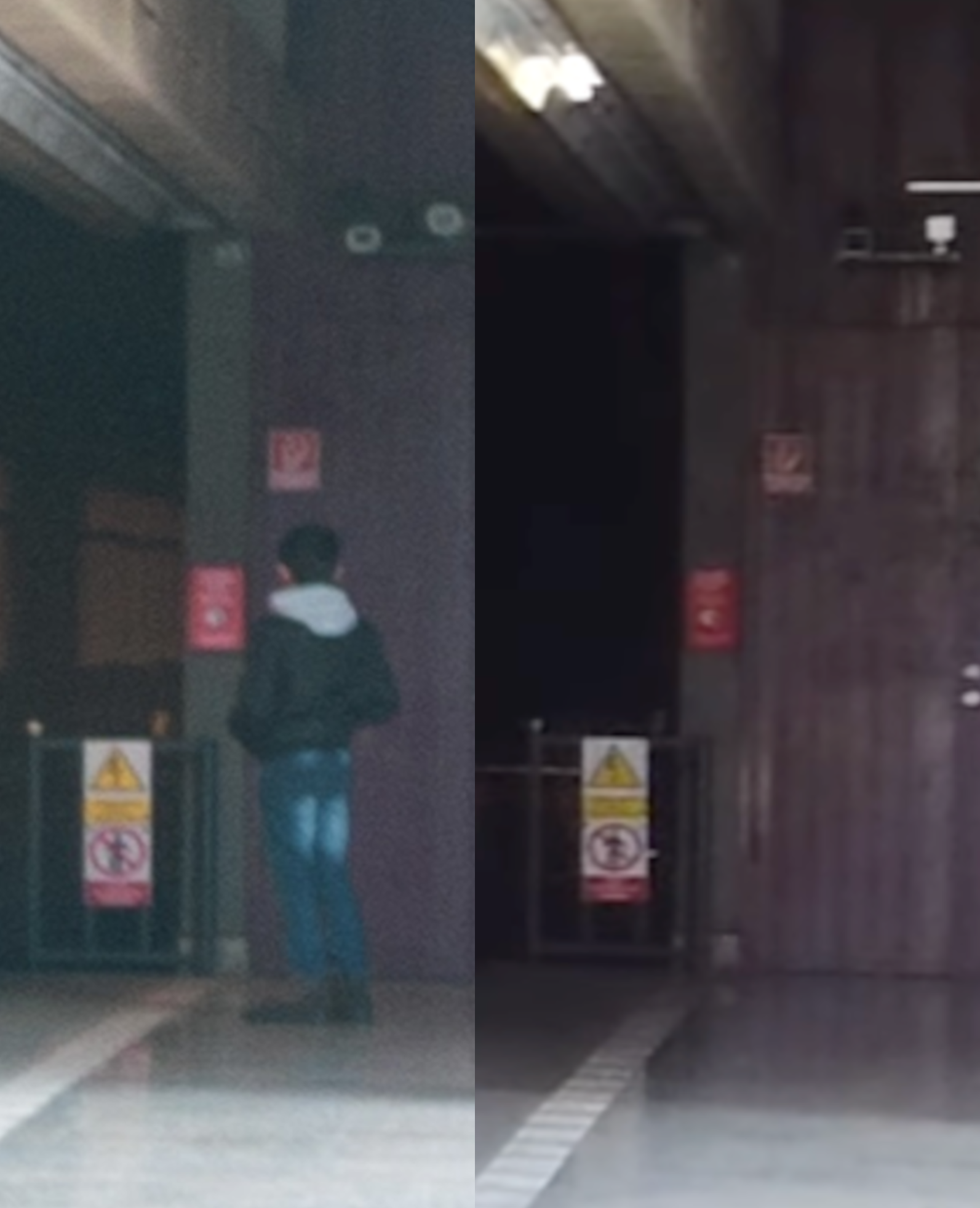
The picture above shows the platform in the direction of Zličín.
Tools & Websites
Youtube, UrbanRail.net, Wikipedia, Google Lens.
I do hope this article shed some light on the methods and reasoning that could be used to solve these challenges. If you did not already, check out Bellingcat.com for exciting OSINT challenges.